It is a set of tools for ArcGIS that enable the users to create surfaces.
ZWCAD™ is a cost-effective, CAD solution for the AEC and MCAD industries.
Interactive program for the modelling of liquid surfaces.
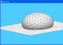
Graphic interactive system for 3D surface modeling
It is a program to view on 3D digital elevation maps mixed with data acquired